Roles and Responsibilities
During the development of this project I was a level designer. Within that role I was responsible for:
- Greyboxing and 3D concepting
- Budgeting and breaking down design workloads
- Communicating design needs to art teams and finding solutions within Minecraft's limitations
- Creating final environments
- Communicating the historic events of Scotland through environmental storytelling
- Historic accuracy checks
- QA testing
- Creation of release materials such as advertising videos and high resolution image compositions
Development Breakdown
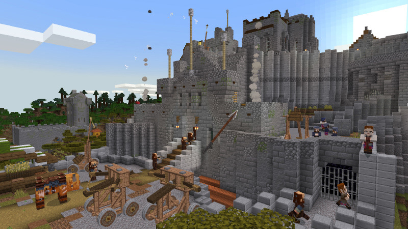
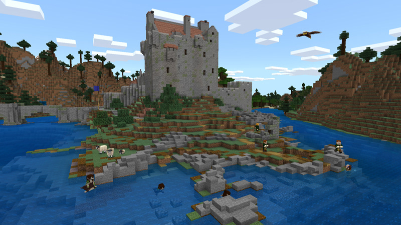
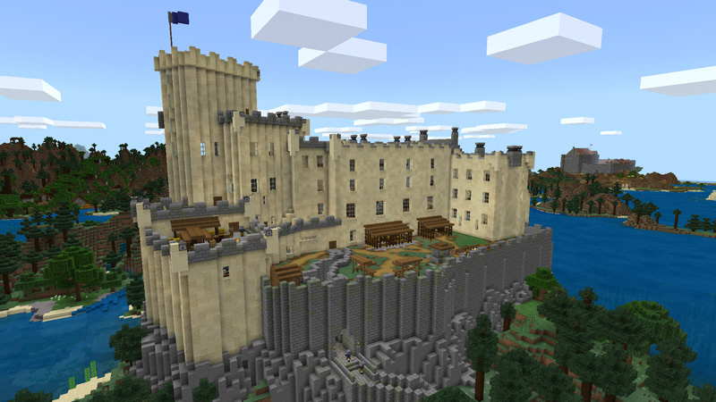
This title used Minecraft to recreate my home country of Scotland, its iconic geographic locations, and its famous castles, keeps, and landmarks.
The world was presented as it would have looked during the middle ages and featured additional content such as useable siege engines which were not native to the base game of Minecraft.
On this title I worked as a level design and QA tester.
I was responsible for many of the castles, their local geographic features, and environmental story telling which aimed to establish the time period as well as inform players on events which occurred in Scotland and its castles during the middle ages.
Capturing Real World Geography
To capture the country and its geographical details a height map was used to generate Scotland as a playable Minecraft world. The height map was generated by taking the most recent height data of Scotland and converting it into a format compatible with our development tools.
Due to the size limits of a Minecraft world the height map's outputs had to be scaled to fit the world limits.
This meant that much of the terrain had become steeper than expected and required a clean-up pass before work could begin.
Within this clean-up there was particular attention dedicated to key locations, such as Loch Ness and Ben Nevis to ensure they were accurately captured.
Research Driven Level Design
Once the terrain was traversable and more reflective of the many diverse environments within Scotland's geography, the positioning and construction of the most iconic castles began.
This was a large research task as well as a level design task. We built the castles to be fully explorable and aimed to uphold interior accuracy as well as exterior.
To achieve exterior accuracy birds eye images of the castles which featured a measurement scale were used.
These were placed into Photoshop and a grid was placed over each image which broke it into meter boxes based upon the scale given in the original image.
Once this grid was created the level design team had a foundation map of each castle as Minecraft blocks are all a cubic meter.
With foundation scales solidified it was possible to accurately determine the height of each castle and its substructures and construct these as hollow shells within the level.
Once the exteriors were constructed research began on interior layouts in each castle and exterior detailing.
Due to the scaling of blocks within Minecraft, and castle interiors changing over time, we had to be very selective about what details we included within each structure's interiors and outer walls.
To lessen the impacts of this concession the level design team prioritized what was indicative of the castle itself, and which details told the castle's story.
Historic Environmental Storytelling
As interiors were populated, each castle aimed to feel like a bustling hub packed with commerce, craft, and vocations associated with the time period.
We wanted to show the events of Scotland during the middle ages through the entire map. We re-created small towns and hubs which were prominent at the time and matched the details in each town to what it was known for.
This could be seen in the Shetland isles and Orkney. Viking raider vessels and settlements were created here and accompanied by famous ruins from locations the Vikings had sacked.
Quality Assurance Testing
Quality assurance testing on this title was focused on navigation and survivability.
Quality assurance testing on this title was focused on navigation and survivability.
As players were likely to use the castles as strongholds to live within during survival gameplay it was important that players had the resources on demand within these structures to gain a foothold during play.
To ensure this was achieved, and remained balanced across the map, each castle had starting resources added to chests around their interiors. These resources aimed to set players up for exploring outward from their castle of choice and to scavenge from the surrounding environment for progression.
To build upon the idea of castles being the ultimate survival points within the map lighting had to be extensively tested within each castle.
Lighting in Minecraft is measured on a 15 level scale. Lighting level 7 or below is deemed dark enough for hostiles to spawn within. To stop enemies spawning within the castle interiors, I created a spec for a tool which highlighted areas of level 7 or below lighting so that this could be addressed and keep the castles safe for players.
Once the castles were tested for survivability and safety; testing turned to navigation and identifying where in the map it was possible to lose bearings and become stuck in the wilderness.
The results of this testing gave the level design team a framework to create pathways and roads which linked castles, small settlements, and geographic locations to aid players in navigating the world. We dressed these roads as dirt tracks to uphold historic accuracy on where main roads existed.

